
Software for construction · Surveying · BIM · Mixed reality
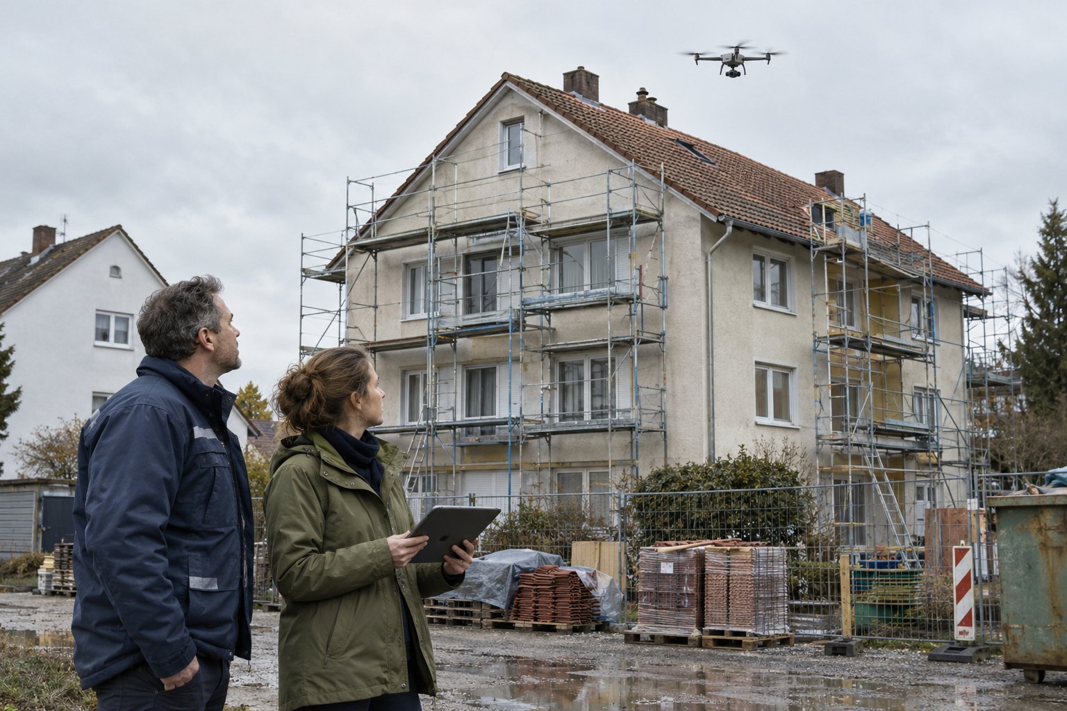
In construction projects, information is regularly lost at three points: when surveying the existing building, when explaining the planning to people who cannot read plans, and when coordinating variants.
For each of these work steps we at EXCIT3D have developed software: the 3DMapper for drone surveys, the IFC XR Viewer for BIM models in virtual and mixed reality, and HolonMR for joint walkthroughs at a scale of 1:1. The applications can be used independently of each other; the results of one can be reused in the next.
-
Step 1 · Capture
Drone surveys of existing buildings, roofs and plots. Measurement and export of the 3D model via the online platform.
ResultMeasurable 3D model of the existing building
-
Step 2 · Understand
IFC models in virtual and mixed reality, with layers, trades and component groups that can be shown and hidden.
ResultBIM model with layer structure in the headset
-
Step 3 · Decide
An AI creates a true-to-scale scene from models, plans and photos that several people walk through together, also on the construction site.
ResultShared scene at a scale of 1:1
Step 1 · Capture3DMapper: surveying by drone instead of scaffolding
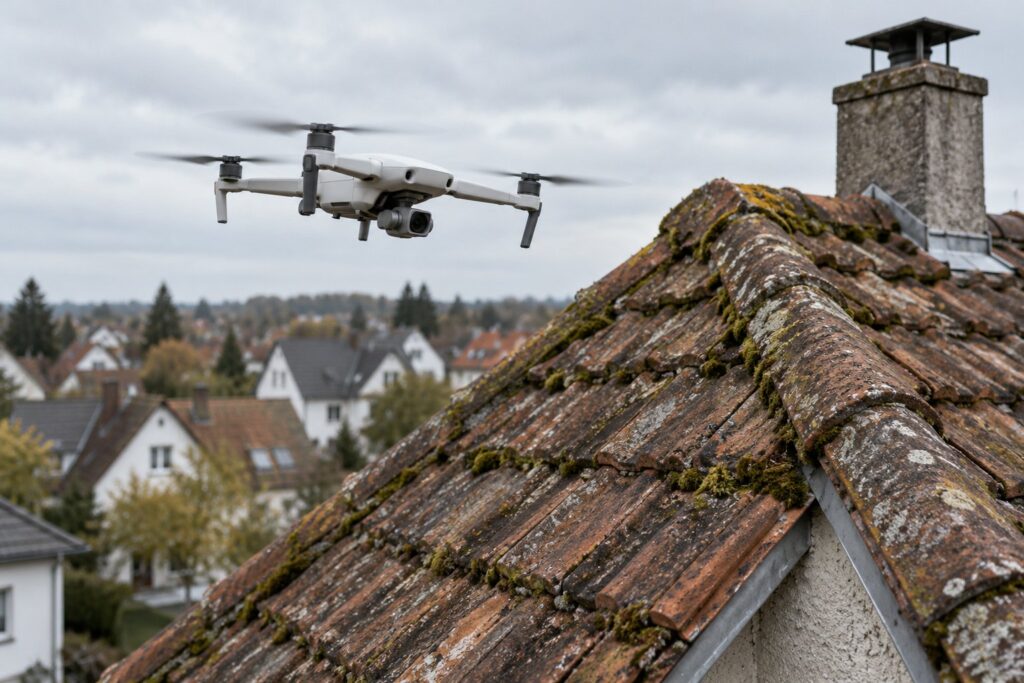
The 3DMapper captures existing buildings, roofs, facades, terrain and infrastructure from the air. The drone images are turned into a detailed 3D model that is measured, analyzed and processed for planning on our online platform. Extensions or fittings can be placed in the existing building as 3D models; the finished model is exported and taken over into your own workflows.
Neither scaffolding nor roof access is needed for the survey, and areas that are hard to reach are captured in high resolution. The 3DMapper is in use in several hundred projects. A customer from the photovoltaics industry and its partners completed 200 projects with the roof measurement app within four months.
Who it is for
- Architecture and engineering firms
- Surveys of existing buildings for conversion, extension and renovation, including listed buildings. From a single building to an entire neighborhood.
- Photovoltaics and roofing
- Measure roof areas, pitches and roof structures without stepping onto the roof.
- Developers and municipalities
- Plots and existing neighborhoods as a planning basis and for presentation to committees and the public.
Step 2 · UnderstandIFC XR Viewer: BIM models with layer structure in VR and mixed reality
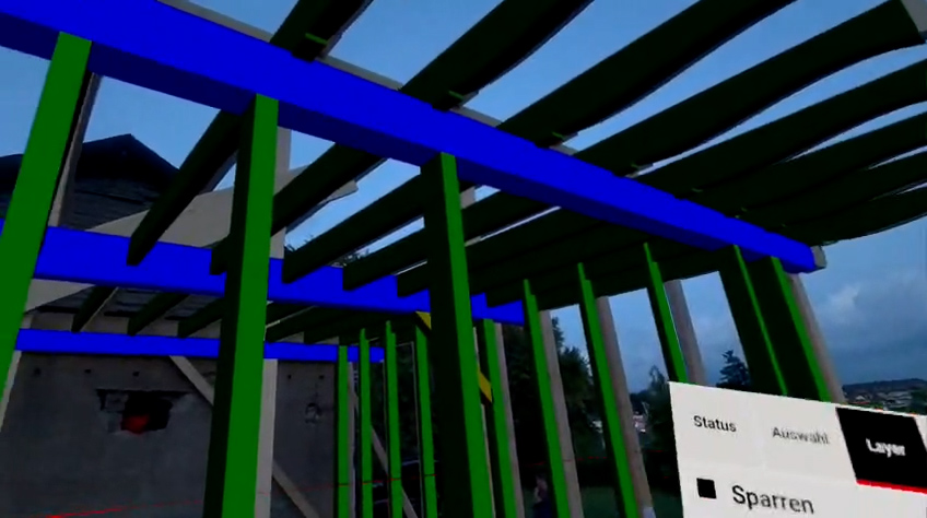
Desktop IFC viewers show the structure of a model in the model tree: component classes, floors, trades, materials. When converting for standalone headsets this structure was usually lost so far; only the geometry remained. Our converter transfers the IFC structure to the headset. In virtual and mixed reality, structure, roof construction, facade, building services and interior finishing can be shown and hidden individually; materials and variants can be compared directly.
IFC (Industry Foundation Classes) is the vendor-neutral standard format for exchanging BIM models between planning programs.
The idea came from Zimmerei Merten in Wuppertal: the carpentry business wanted to hide a roof structure layer by layer on the construction site in mixed reality, from the roof covering through the rafters to the purlins. Today we develop and market the viewer together for the construction industry.
Who it is for
- Architecture and specialist planning
- Check designs at a scale of 1:1, follow pipe and cable routing and clashes in the room.
- Construction companies and trades
- Compare planning and execution on the construction site, clarify complex connections before installation.
- Clients
- Walk through planned rooms at a scale of 1:1 before construction starts and compare variants.
Step 3 · DecideHolonMR: joint walkthroughs at a scale of 1:1
HolonMR creates a 3D scene you can walk through from existing project data, without rebuilding models. Input can be 3D models, 2D plans, DWG files, renderings and photos; an AI combines them into a true-to-scale scene. In the web browser the team annotates and versions the scene and then releases it for the headsets.
The core of the application is co-location: several people at the same place see the same scene at a scale of 1:1, for example investor, planners and site management. This also works offline on the construction site. Without a headset, the scene can be viewed on a PC and on a smartphone.
We developed HolonMR for the E-Gruppe, which presents the solution officially. Today we also offer HolonMR to other companies in the construction industry.

Who it is for
- Project developers and investors
- Make projects walkable before planning becomes expensive, and compare variants in the room instead of in renderings.
- Developers and general contractors
- Bring client, architects and contractors together in one scene to reduce coordination rounds and change orders.
- Municipalities and committees
- Present construction projects in an understandable way to decision-makers who cannot read plans.
How the three applications work together
The drone model from the 3DMapper documents the existing building. The IFC model from the planning describes the target state; the IFC XR Viewer makes it possible to check it in the headset layer by layer. HolonMR combines the model of the existing building, planning, renderings and photos in a shared scene in which those involved coordinate variants. Each application can also be used on its own.
Test with a project of your own
Which application fits is best clarified with a specific object. We measure a roof as a test, convert one of your IFC files or show you HolonMR with your project in a video conference.
Software for construction · EXCIT3D GmbH, Solingen
info@excit3d.de · +49 212 26049777
Frequently asked questions
Do I have to use all three solutions?
No. Each application can be used on its own. Customers usually start with the work step that currently causes the most effort.
Do I need a mixed reality headset?
Not for the 3DMapper, which runs in the browser. The IFC XR Viewer is developed for standalone headsets such as the Meta Quest 3. HolonMR runs on headsets, on PCs and on smartphones; a headset is optional there.
Can I use the drone model in the IFC XR Viewer or in HolonMR?
In HolonMR yes, 3D models and photos are part of the input data there. The IFC XR Viewer needs an IFC model from the planning; the drone model serves as the basis for the existing building.
Who is behind the solutions?
We developed all three applications at EXCIT3D in Solingen, the IFC XR Viewer together with Zimmerei Merten from Wuppertal and HolonMR for the E-Gruppe.
How do I get started?
With an object of your own: a roof to measure, an IFC file to convert or a project for a HolonMR demo. Write to us with what you would like to start with.
More on this topic: 3DMapper · IFC XR Viewer. Topics: construction, construction industry, BIM, IFC, drone surveying, surveys, mixed reality, virtual reality, XR, AI, co-location, architecture, specialist planning, construction companies, trades, project development, photovoltaics, digitization
More projects by EXCIT3D
Annual review · 2024 Review 2024 The most successful year in EXCIT3D’s history so far. From the Willy Brandt bust to the virtual Goslar Cathedral: all projects of the year. Annual review · EXCIT3D GmbH, Solingen 2024 was by far…
Weiterlesen →AI · Virtual reality · Construction AI Studio Munich · 2024 AI on the construction site, experienced in VR. A VR demonstrator on construction site logistics, developed with Fraunhofer IAO. The Construction Pioneer · EXCIT3D GmbH, Solingen · © EXCIT3D…
Weiterlesen →Virtual reality · 360° · Education for sustainable development Nicaragua · Honduras · Solingen · 2024 Climate protection projects from Central America in 360° and VR. Young people from Nicaragua and Honduras show in 360° films how they reforest mangroves…
Weiterlesen →About EXCIT3D GmbH
We develop applications where 3D technology, augmented reality, virtual reality and software development meet. For industry, culture and public clients we build solutions from the first idea through 3D data processing and user interface to live operation. We are based in Solingen, Germany.